The Lost Franklin Expedition: 129 Men Sailed North and None Came Home
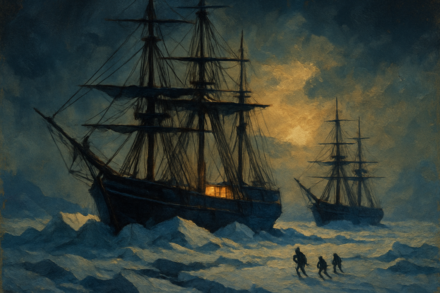
They carried three years of provisions, a library, fine china, and a hand-organ that could play fifty tunes. What they did not carry home was a single survivor.
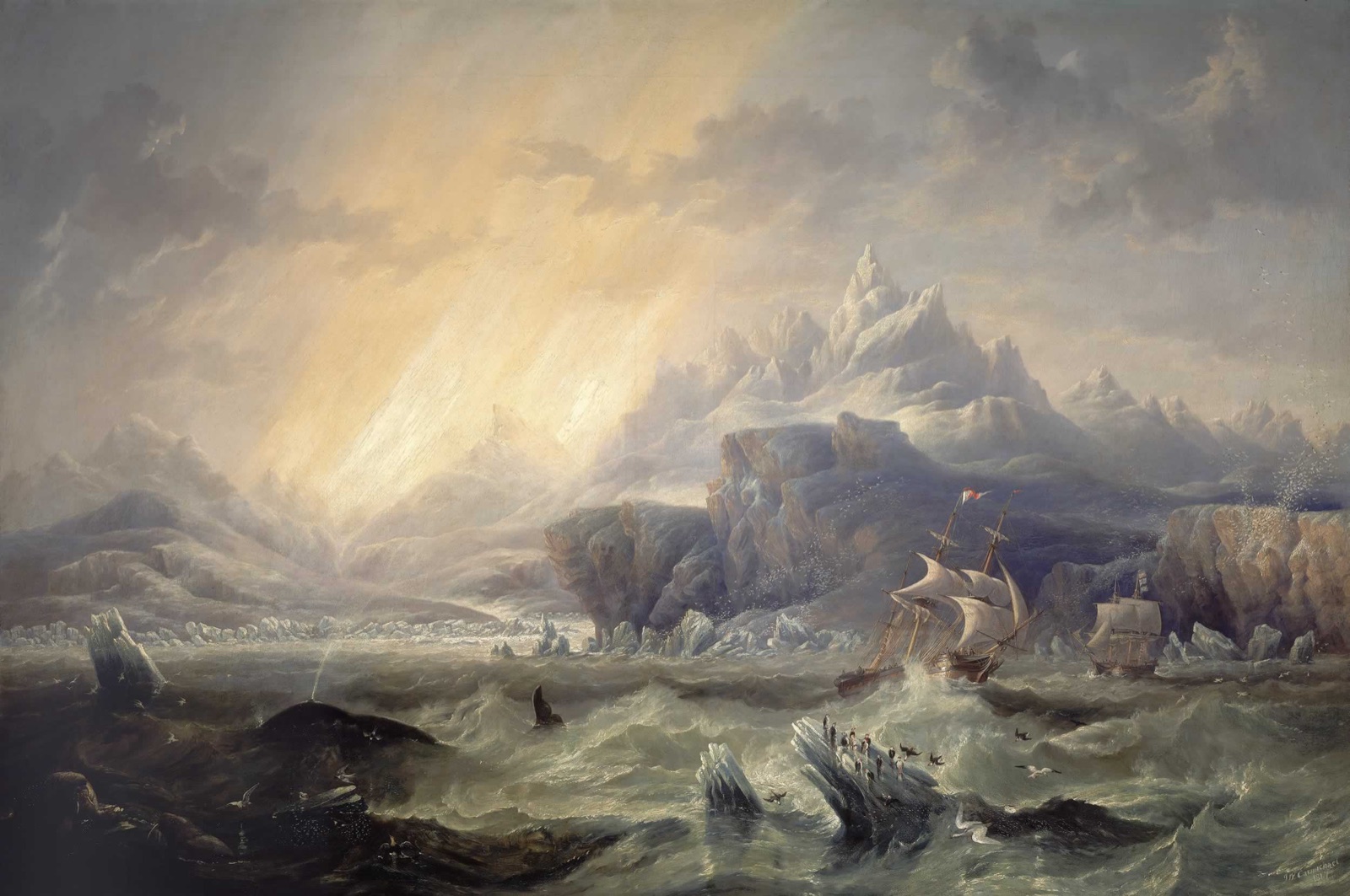
In May 1845, HMS Erebus and HMS Terror sailed from England under Sir John Franklin to force the last unnavigated stretch of the Northwest Passage — the fabled sea route over the top of North America. The two ships were the most advanced polar vessels of their age: reinforced hulls, retractable propellers, steam heating, and enough tinned food for 129 men to last well beyond the season. Whalers spotted them moored to an iceberg in Baffin Bay that July, waiting for a lead to open. After that, nothing. No message, no wreck, no bodies — only silence that stretched across a decade and set off the largest search operation the world had ever mounted. The mystery of what happened to Franklin's men became the defining Arctic obsession of the nineteenth century, and it stayed unsolved for 170 years.
The Location
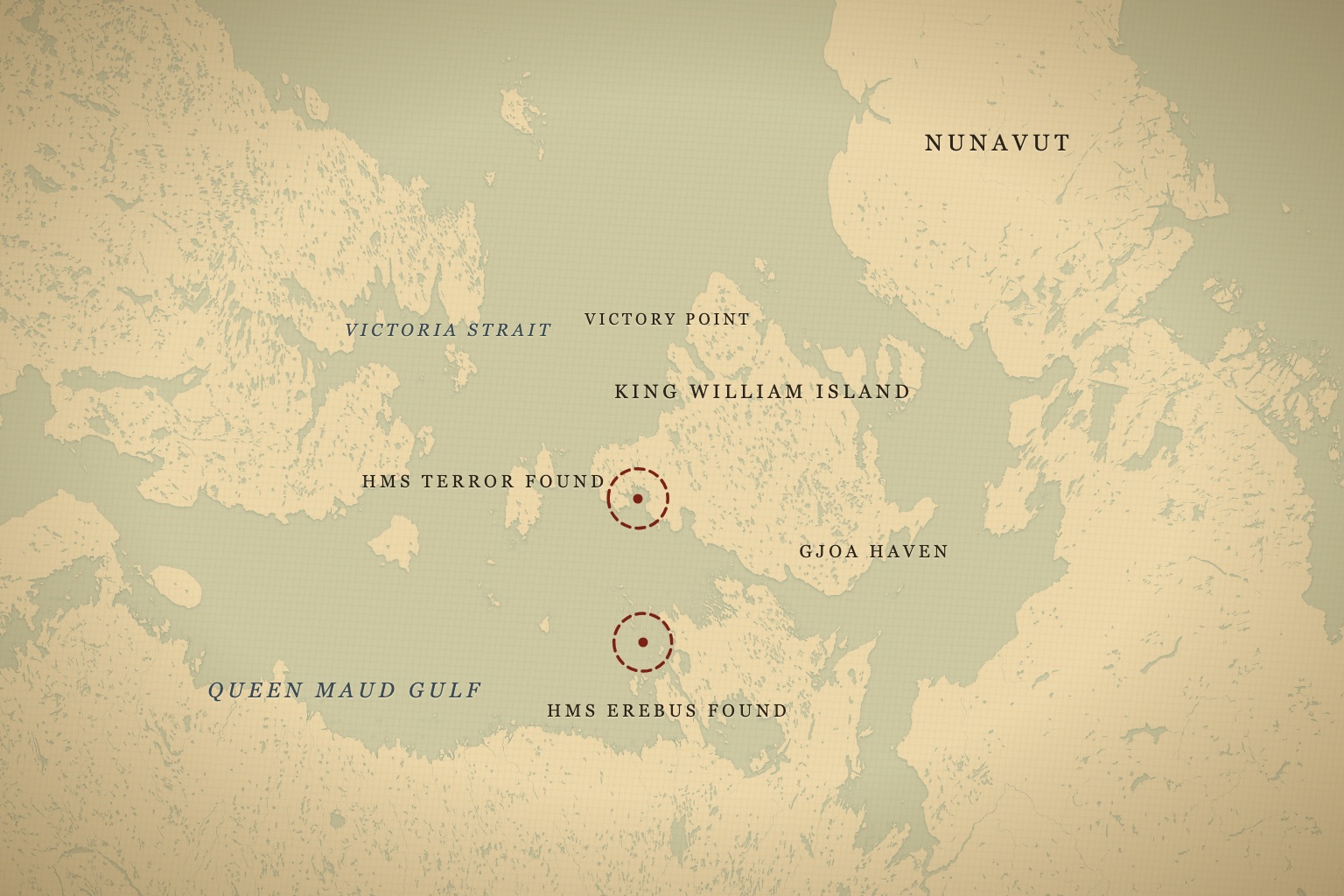
The stage for the disaster is one of the most punishing landscapes on Earth: the archipelago of islands and frozen channels that stretch north of mainland Canada toward the pole. Franklin's ships were last confirmed near Beechey Island, where the expedition spent its first winter, before pushing south and west into the maze of ice around King William Island — a low, treeless expanse in what is now the territory of Nunavut, roughly 1,200 kilometers north of the Arctic Circle.
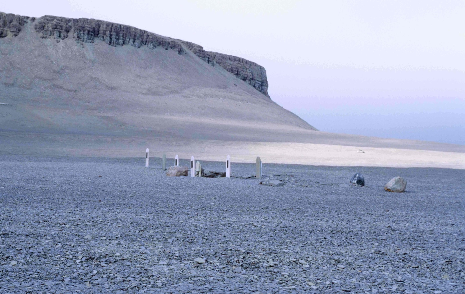
Beechey Island itself would later become a grim signpost. It was there that searchers in the early 1850s found the expedition's first winter camp, complete with the graves of three crewmen who died in the winter of 1845–46. The tidy stone-lined graves, the piles of discarded tin cans, and the remnants of a workshop and storehouse told investigators that the men had wintered in reasonable order and good spirits. Whatever went wrong happened later, deeper into the ice, out of reach of the search vessels of the era.
This was the crux of the Northwest Passage problem. The waters west of King William Island are choked by thick multi-year pack ice streaming down from the polar sea, and in the 1840s no one knew that a ship hugging the island's eastern shore might have found clearer water. Franklin went west. His ships became trapped in the ice off the island's northwest coast in September 1846 and never sailed freely again. The decision was not reckless by the standards of the day — the charts were incomplete, the theory of an "open polar sea" still lingered in Admiralty thinking, and the western route looked like the logical way through. It was simply, and fatally, wrong.
The region is bleak, remote, and for most of the year sealed under ice. Winter temperatures plunge far below freezing, the sun disappears for weeks, and the pack ice can grind a wooden hull to splinters or hold it fast for years at a time. It is the kind of place where a shipwreck can lie undisturbed for well over a century, and where the truth survives mainly in the memory of the people who have always lived there: the Inuit. For them, King William Island — Qikiqtaq — and the surrounding waters were not an abyss but a homeland, hunted and traveled long before European ships ever appeared on the horizon and long after they sank.
The Hunt
The Franklin mystery is the ultimate Arctic cold case, and the modern hunt for the ships combined nineteenth-century detective work with twenty-first-century technology. The nineteenth-century phase alone was staggering in scale. When the ships failed to return, Franklin's widow, Lady Jane Franklin, campaigned relentlessly, funding expeditions out of her own resources and pressuring the Admiralty and the public to keep looking. Dozens of ships and hundreds of men fanned out across the Arctic over the following years, and the search itself mapped huge stretches of previously unknown coastline — an ironic legacy, given that the men doing the mapping were hunting for corpses.
For generations, searchers dismissed the one body of evidence that turned out to matter most: Inuit oral testimony. As early as the 1850s, Inuit hunters had told searchers of starving white men dragging boats south, of ships crushed in the ice, and of a wreck they had visited and stripped for wood and metal. These accounts were treated as unreliable folklore by British authorities for over a century, filtered through prejudice and the assumption that Indigenous memory could not be trusted against the written record of Royal Navy officers.
They were, in fact, remarkably accurate. The breakthrough of the modern era came when Parks Canada's underwater archaeology team, working with a coalition of partners including the Government of Nunavut and drawing directly on Inuit knowledge, mounted a series of survey expeditions. Louie Kamookak, an Inuit historian from Gjoa Haven, spent decades collecting and cross-referencing oral histories from his elders against the historical record — work that proved essential in narrowing the search. His research pointed investigators toward the waters where local testimony placed a sunken ship. Kamookak's lifelong effort bridged two ways of knowing: the stories passed down through generations of his community, and the archival record of British naval documents, and he insisted that the two, read together, told a consistent story.
In September 2014, a Parks Canada team using side-scan sonar and a remotely operated underwater vehicle located HMS Erebus in shallow water in eastern Queen Maud Gulf, south of King William Island — almost exactly where Inuit accounts had long said a ship went down. The wreck lay only a few meters beneath the surface, so shallow that its upper deck was within reach of divers. Two years later, in September 2016, the Arctic Research Foundation's vessel Martin Bergmann found HMS Terror in the aptly named Terror Bay, north of the Erebus site, after a crew member recalled an Inuit report of a mast protruding through the ice years earlier. That single remembered detail — a mast in the ice, dismissed for years — turned out to point directly at the ship. Both wrecks were astonishingly well preserved by the frigid water, their hulls largely intact, cabins and fittings sitting in the dark much as they had when the sea closed over them.
The expedition's afterlife on screen is substantial. PBS's NOVA told the story of the Erebus discovery with exclusive access to the Parks Canada search in "Arctic Ghost Ship" (2015), and AMC's The Terror (2018) turned the expedition's final years into a ten-episode drama — fiction wrapped around a meticulously researched core, and for many viewers the door into the real case.
What History Says
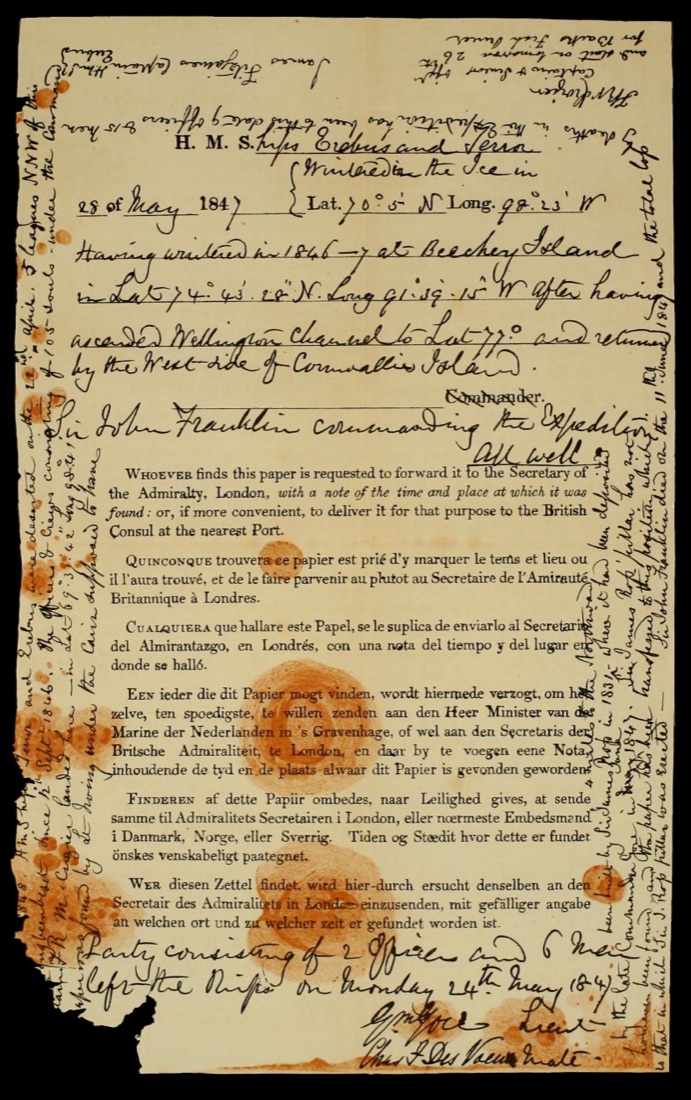
For all the ships that vanished, the expedition did leave behind a handful of clues — enough to sketch the outline of a catastrophe. The single most important document is a note found in 1859 by Francis Leopold McClintock's search party in a cairn on King William Island. Written on a standard Admiralty form — the printed kind meant to be tossed overboard in a sealed container to record a ship's position — it carries two messages. The first, dated May 1847, reports the ships beset by ice but the expedition proceeding, ending with the cheerful "All well." The second, scrawled in the margins and around the edges a year later in April 1848, is grim: Franklin had died on June 11, 1847; 24 men in total were dead; and the 105 survivors, under Captain Francis Crozier, were abandoning the ships and setting out on foot for the Back River on the mainland, hundreds of kilometers to the south.
That contrast — "All well" one year, mass death and desertion the next — is the emotional core of the whole mystery. Something between those two dates broke the expedition, and the note gives no explanation, only the bare arithmetic of loss.
None of them made it. Over the following decades, searchers and Inuit found skeletons, abandoned equipment, and a ship's boat mounted on a sledge scattered along the island's southern coast. That boat, discovered by McClintock, was one of the most haunting finds of all: a heavy craft dragged by men who were starving, loaded with objects of no survival value while essential gear had been left behind, and containing human remains. The remains told a horrifying story. Forensic study of recovered bones has documented signs of scurvy, starvation, and — most disturbingly — cut marks consistent with cannibalism, corroborating Inuit accounts that had described exactly this to searcher John Rae in 1854. Rae had gathered his information honestly from Inuit informants and reported it plainly to the Admiralty. His report caused a scandal in Victorian England; Charles Dickens publicly attacked the very idea that British sailors could have resorted to eating their dead, insisting the "savages" must have been responsible. The bones, examined more than a century later, proved the Inuit right.
The cause of the collapse is still debated. Early studies pointed to lead poisoning — possibly from the ships' poorly soldered tinned-food cans or the ships' internal water system — after high lead levels turned up in tissue and bone samples exhumed from the Beechey Island graves in the 1980s. The theory was compelling: lead in sufficient quantities damages the nervous system and impairs judgment, which might explain some of the disastrous decisions the men made. More recent analysis has cast doubt on lead as the decisive factor, noting that the crews' lead exposure may not have been dramatically higher than was ordinary for the period, and suggesting that starvation, scurvy, tuberculosis, and the sheer brutality of the environment were more than enough on their own to destroy a stranded expedition. The likeliest answer is not a single cause but a cascade: ships trapped, food spoiling, disease spreading, morale collapsing, and finally a desperate march that no one could survive.
The Verdict
We now know where the ships lie, and both Erebus and Terror are protected as a National Historic Site, jointly stewarded by Parks Canada and Inuit. Ongoing dives have recovered hundreds of artifacts from Erebus — dishes, a lieutenant's epaulette, even a sealed bottle — and archaeologists hope the sediment-filled cabins may yet yield documents or personal writing that could finally explain the expedition's last decisions. The cold, dark water that killed the men has also, in a bitter irony, preserved their world: leather, paper, and wood survive under Arctic silt in conditions that would have rotted them away almost anywhere else. Somewhere in those flooded cabins there may still be a logbook, a letter, or an officer's journal waiting to be read.
But the central question endures. We still do not know precisely why 105 men left their provisioned ships to march across open tundra toward almost certain death, or whether some later returned to reman a vessel and sail it partway south, as the surprisingly southerly position of Erebus hints. Nor do we know exactly when the last man died, or where. The wrecks are real, the graves are real, and the Inuit who guided searchers to them — and who were doubted, dismissed, and slandered for their trouble — were telling the truth all along. That may be the most enduring lesson of the whole affair: the empire that sent the ships spent decades and fortunes searching for answers that the people of the land had been offering, patiently and accurately, the entire time.
What remains buried — under Arctic silt and 180 years of ice — is the story the men themselves would have told, if any had lived to tell it.
Explore the sites mentioned in this post on the interactive map.
Open the Tracker